
FedGeoDay 2024
APRIL 30 | Plenary Sessions
Registration starts at 8:30 AM and Sessions start at 9:30 AM
Location: Yates Auditorium & the American Red Cross
MAY 1 | Workshop Day
Registration starts at 8:30 AM. Morning Workshops start at 9:00 AM, afternoon workshops start at 1:00 PM.
Location: American Red Cross
Join fellow open source enthusiasts at the 2024 FedGeoDay! Our main sessions will be held April 30 at the Department of Interior Yates Auditorium and the American Red Cross, with a day of workshops on May 1. FedGeoDay will be in person this year and there will be no livestreaming. As always, FedGeoDay is free to attend for .gov .mil .edu and .org attendees.
Keynote Speaker

Dr. Budhendra “Budhu” Bhaduri
Corporate Research Fellow and Director of the Geospatial Human Security Division
Oak Ridge National Laboratory (ORNL)
We are pleased to welcome Dr. Budhendra “Budhu” Bhaduri as our Keynote Speaker. Dr. Bhaduri is a Corporate Research Fellow and the director of the Geospatial Science and Human Security Division at Oak Ridge National Laboratory (ORNL). In that capacity he is responsible for a research portfolio focusing on novel implementation of geospatial science and technology across energy, environment, and national security missions. His research has had global impact and has benefited the U.S. federal missions, international organizations, and private foundations. He has served on the Geographical and Geospatial Sciences Committee of the national academies and is a fellow of the American Association for the Advancement of Science and the American Association of Geographers.
Keynote Fireside Chat

Dr. Nadine Alameh
Executive Director
Taylor Geospatial Institute
After our Keynote Speech, Dr. Nadine Alameh will lead a Fireside Chat to continue the discussion around how open source software can assist us in building open source assets. Dr. Alameh is the inaugural Executive Director of the new Taylor Geospatial Institute, a new institute in the US, founded to fuel geospatial science and technology with a consortium of academic & research organizations in the Midwest. Dr. Alameh is a recognized leader (and cheer-leader) in the geospatial field with experience in Aviation, Intelligent Transportation Systems, Earth Observations, Public Safety, and Defense. Prior to joining the Taylor Geospatial Institute, she was CEO & President of the Open Geospatial Consortium (OGC) where she led the global consortium in making geospatial information Findable, Accessible, Interoperable, and Reusable (FAIR).
Conference Co-Chairs

Karla Riso
Geographer
Census Bureau

Eddie Pickle
Senior Vice President
Crunchy Data

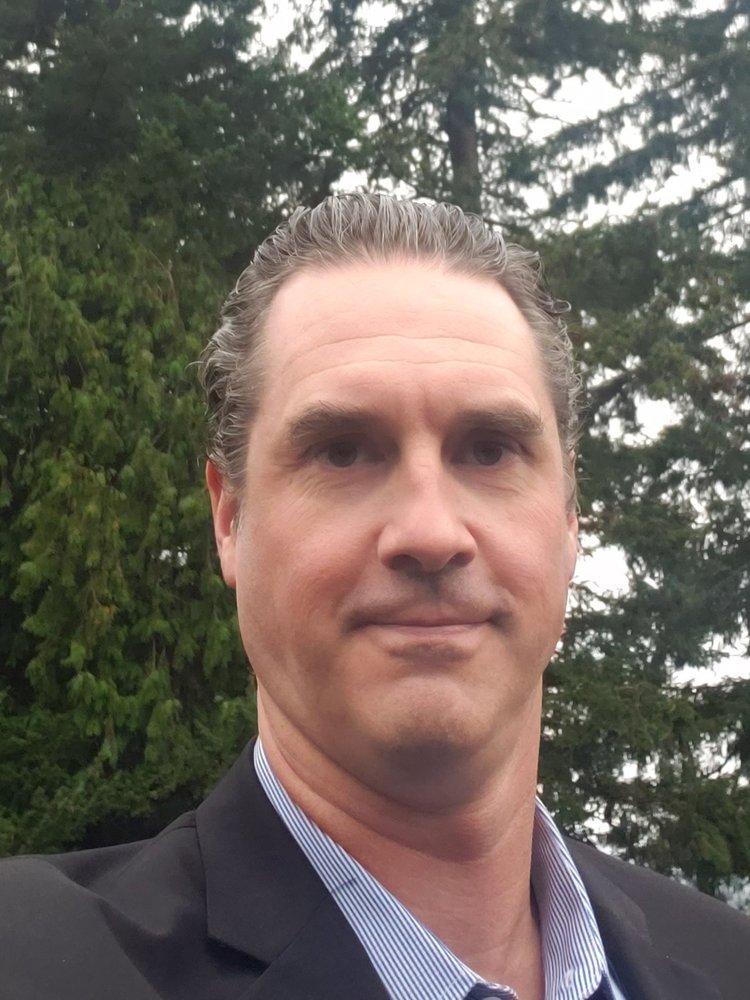
Bill Dollins
Founder and President
Cercana
FedGeoDay Venues

Yates Auditorium (Department of the Interior)
Registration and Main Event
Department of the Interior (DOI)
Visitor Entrance on C Street
1849 C Street NW
Washington, DC 20240

American Red Cross Building
Lunch, Workshops, and Closing Reception
American Red Cross Building
Hall of Service Room
1730 E Street NW
Washington, DC 20006
HOSTS

Schedule of Events
Welcome Remarks
Welcome Remarks
Bill Dollins
Founder and President
Cercana
Keynote Speaker
Fireside Chat
Using Open Source Software to Build Open Data Assets
Dr. Budhendra “Budhu” Bhaduri
Corporate Research Fellow and Director of the Geospatial Human Security Division
Oak Ridge National Laboratory (ORNL)
Using Open Source Software to Build Open Data Assets
Dr. Nadine Alameh
Presentations
Open Source for Local Government, Emergency Management & Response, and Climate Risk
Moderator: Ryan Burley
Director of Sales and Business Development
GeoSolutions
We are excited to welcome the following presenters:

Aaron Myers
ORNL

Laura Schuch
Cleveland Metroparks

Mike Rodgers
Critical Response Group (CRG)

Karen Townsend
Sea Island Software (HURREVAC)
Panel

Open Data: Actions and Aspirations
Moderator: Maggie Cawley
Executive Director
OpenStreetMap US
Our esteemed panel includes the following presenters:


Derald Dudley
US DOT

Joel Schlagel
US DOI FEMA & DOI
Carrie Stokes
USAID Chief Geographer and GeoCenter Director
Lunch
Lunch Break
Lightning Talks

The Impending Modernization of the U.S. National Spatial Reference System
Dan Roman
Chief Geodesist
NGS, NOAA
Towards A New US Census Bureau Grid System


Josh Coutts
Geographer
US Census Bureau
Using AI to Refine Open Data in the Geospatial Cloud
Jeremy Malczyk
Cloud Geographer
Google Cloud
Crunchy Data Presents: Modernizing Geospatial Workflows? Start with Your Database!

Eddie Pickle
Senior Vice President
Crunchy Data
NOAA Open Data for Disaster Response

Geospatial Programmer II
RGi
Beth Wiberg
Plenary Talk
Policy & Legal Issues of Special Note to Open Source or Open Data

Kevin Pomfret
Space and Spatial Corporate and Transaction Attorney
Williams Mullen
Panel
Empowering Federal Governance -- The Role of Open-Source Geospatial Solutions and Open Data

Moderator: Aaron Kelley
President
Upslope Advisors
Our esteemed panel includes the following presenters:
Kirk Waters
NOAA

Tom Fitzwater
US Census

Josh Campbell
DOS

Andrew Bulen
USGS
Panel
Silicon Dream or New Reality? AI in Remote Sensing

Moderator: Lauren Frederick
CTO
Element 84
Our esteemed panel includes the following presenters:

Everett Hinkley
US Forest Service


Carter Christopher
ORNL
Dr. Michael Tischler
Director of the National Geospatial Program (NGP)
U.S. Geological Survey (USGS)

Joe Foster
NASA

Manil Maskey
NASA
Closing Panel
Into the Great Wide Open: What’s been built, what are the possibilities, and where we’re going.

Moderator: Terry Busch
General Partner
Wave Data
Our esteemed panel includes the following presenters:

Dan Pilone
Element 84

Chad Shuey
EpochGeo

Eric Finnen
NGA
Closing Remarks
Reception and Networking
Closing Remarks

Executive Director
Taylor Geospatial Institute
Dr. Budhendra “Budhu” Bhaduri
Corporate Research Fellow and Director of the Geospatial Human Security Division
Oak Ridge National Laboratory (ORNL)
Eddie Pickle
Senior Vice President
Crunchy Data
Special Guest Speaker
Lee Schwartz
Geographer of the United States
US State Department
What is FedGeoDay?
FedGeoDay is THE event devoted to "open geospatial ecosystems" (open source software, open/collaborative mapping, open science challenges, and open engagements) that are used to initiate and grow capabilities across the U.S. federal government. As always, we will be bringing together federal program managers, technology leaders, industry partners, NGOs, and many others to share ideas, learn, and network.
Check out great content from previous FedGeoDays on our About page.